Everything You Need To Know About Inland Waterways
Introduction:
For the purpose of developing and regulating inland waterways for shipping and navigation, India's Inland Waterways Authority (IWAI) was established in October 1986. On national waterways, the Authority carries out a variety of infrastructure development projects. Additionally, it conducts feasibility research and draughts applications for other waterways to be designated as National Waterways. Additionally, it aids States in developing the IWT industry and offers IWT operators subsidies for the purchase of IWT fleet for the transportation of goods and people.
Basic Information:
Any nation's economic growth depends on the development of an effective transportation industry. Effective transportation becomes essential to foster a competitive economic climate in a vast nation like India. There are several different kinds of transportation in India, including roads, railways, inland waterways, coastal shipping, and airplanes.
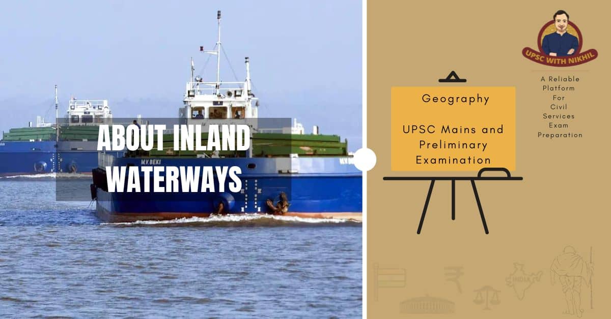
Ship:
A fuel-efficient, environmentally friendly, and economical means of transportation, inland water transport (IWT) has the potential to relieve the strain on overloaded rail and congested highways. To do this, however, it is essential that public financing be used to develop IWT mode at least to the point at which the private sector would be interested in it.
IWT was a crucial form of transportation in the 19th and first half of the 20th centuries, and the expansion of trade and commerce along numerous rivers and canals was greatly aided by the use of power boats and country boats for navigation. The development of railroads and the expansion of their network reduced India's reliance on water transportation. The IWT sector was marginalized in the later years of the 20th century, with the exception of a few places like Assam, Goa, Kerala, Mumbai, West Bengal, and some other coastal areas (where it has a natural advantage and no developmental intervention was needed).
This was due to the rapid growth of roads combined with the inadequate development of the IWT sector over the years. The fact that numerous Committees have periodically evaluated the nation's IWT system since independence and urged for its systematic growth, however, shows that the need for the IWT sector's systematic development was always felt despite its inherent advantages. In response, the National Transport Policy Committee proposed in its report from 1980 that an authority be established for the development and management of inland waterways, which resulted in the establishment of the Inland Waterways Authority of India (IWAI) in 1986.
IWAI carries out infrastructure upkeep and development tasks on the National Waterways. It also carries out techno-economic feasibility studies, draughts proposals for other canals to be designated as National Waterways, advises the Central Government on IWT-related issues, and works with States to promote their IWT industries.
According to constitutional rules, only waterways that have been designated as National Waterways are subject to the control of the Central Government, all other waterways remain under the control of the appropriate State Government.
Since the IWAI was established, five waterways, namely:
• The Godavari and Krishna rivers, the Ganga Brahmaputra West Coast Canal with Udyogmandal and Champakara Canals, the Kakinada-Puducherry Canal System, and the East Coast Canal with the Brahmani River and Mahanadi Delta have all been designated as National Waterways.
The Central Government is contemplating designating the Barak River as a National Canal for yet another waterway.
Waterways Named By The National Transport Policy Committee For Nomination As National Waterways:
The following guidelines were recommended by the National Transport Policy Committee in 1980 for the declaration of a national waterway.
• It should be able to be navigated by vessels that are reasonably sized and mechanically powered.
• The channel should be at least 1.5 meters deep and roughly 45 meters broad.
• It should be a continuous 50 kilometer span.
• Urban agglomerations and intra-port trade are the only exceptions to the rule regarding waterway length.
• It ought to go through and advance the objectives of many States.
• It ought to link major ports with a broad and rich hinterland.
• It ought to travel through an area of strategic importance where navigational advancement is deemed important to give logistical assistance for national security.
• It ought to link locations that aren't accessible by other forms of transportation.
The following waterways were identified by the National Transport Policy Committee as having the potential to be designated as national waterways.
1. Sunderbans
2. Mahanadi
3. Narmada River
4. Goa's Mandovi, Zuari, and Cumberjua Canals
5. Tapi
Establishing the potential and viability of a canal requires hydrographic surveys and techno-economic feasibility studies. The Ganga, the Brahmaputra, and the West Coast Canal have all been designated as national waterways as a result of extensive surveys and investigations that have been conducted on all the aforementioned rivers. During the ninth Plan period, the development of numerous additional new rivers as national waterways is planned.
Background:
One of the 108 levels planned for project India-WRIS is called "Inland waterways". There are approximately 14,500 km (miles) of navigable waterways in India, including rivers, canals, backwaters, creeks, etc. Inland Water Transport (IWT), a fuel-efficient and environmentally beneficial means of transportation, moves over 55 million tons of freight each year. The Ganga, Bhagirathi, and Hooghly rivers, the Brahmaputra, the Barak River, the rivers in Goa, Kerala's backwaters, Mumbai's inland waters, and the deltaic areas of the Godavari and Krishna rivers are the only places where it is currently permitted to operate.
Country boats of varying capacities also operate in numerous rivers and canals in addition to these planned activities by mechanized vessels. Significant amounts of passengers and cargo are also moved in this unorganized sector. The Champakara and Udyogmandal Canals (205 km) in Kerala, the Kollam-Kottapuram stretch of the West Coast Canal, the Sadiya-Dhubri stretch of the river Brahmaputra (891 km), and the Ganga-Bhagirathi-Hooghly between Allahabad and Haldia (1620 km) in UP, Bihar, Jharkhand, and West Bengal have all been designated as national Waterways.
Five sectors, designated as NW-1, NW-2, NW-3, NW-4, and NW-5, have each undergone a hydrographic study by the Indian Waterways Authority of India (IWAI). Here is a brief explanation of these stretches.
Construction of National Waterways:
For the development of waterways, there are three fundamental pieces of IWT infrastructure:
1. A navigable waterway or fairway with the necessary width and depth.
2. navigating aid for safety
3. Terminals for docking ships, loading/unloading cargo, and serving as a road and rail link.

Inland vessels for the transportation of goods and people are the fourth element required for the operationalization of a workable IWT system. It is anticipated that after a threshold level of fairways, terminals, and navigational aids has been reached, private sector investment in inland vessels will rise as a result of market forces, increasing the inland fleet. On National Waterways, numerous projects are being carried out for the provision and maintenance of fairways, terminals, and navigational aids.
The National Waterways No. 1 and 2 are typical alluvial rivers with braiding, meandering, and significant horizontal and vertical water level fluctuations between summer and monsoon months.
Several shallow spots (shoals) appear on these rivers during the low water season, making it challenging to maintain the 2m Least Available Depth, especially in the higher portions. Since the shoals in these rivers need to be re-identified after every monsoon and remedial actions (River Conservancy works) started, conservation works (dredging and bandalling) must be done on them every year. On the other side, NW-3 is a tidal canal with predictable and consistent tidal water level change. Therefore, once the appropriate depth is achieved on this waterway through capital dredging, it can be maintained for a number of years by performing minor maintenance dredging as needed.
NW-4 and 5 have sections of both a canal and a river. The Godavari and Krishna rivers will require regular dredging, and five barrages with navigational locks have been proposed for the Brahmani River, while canal segments must be substantially dredged once to provide depth. After the completion of their DPRs, approval of development projects by appropriate authorities, and provision of sufficient funding by the Government of India, work on NW-4 and 5 will begin. The Ministry of Shipping has already received the PIB note for the development of NW-4 and approved it. The following are some of the additional waterways that have been designated for development during and after the ninth five-year plan:
Sunderban
The Sunderbans delta is traversed by the Sunderbans IWT route leading from Haldia to Bangladesh. The Indo-Bangladesh Protocol includes this tidal inland canal corridor as a trade and transit route. The hydrographic survey was completed in 1988–1989, and a request for its designation as a national waterway was made to the government.
Goa
The National Transport Policy Committee identified eleven waterways, with Goa's waterways being one of them (NTPC). These waterways include the Mondovi and Zuari rivers as well as the 122 km long Cumberjua canal. With over 15 million tons of cargo moving through the waterways each year, mostly iron ore from mines to Marma Goa Port, the waterways are fully operational.
DVC Canal
There is a 136-kilometer navigation canal system that links Durgapur and Tribeni in the Hooghly River. This was a potential canal that needed to be resurrected, according to the Bhagwati Committee. This navigational canal system is the subject of ongoing technological and economic studies and hydrographic assessments. The 9th Five Year Plan included a proposal to revive this canal for the transportation of coal from Durgapur mines to various locations in NW-1 and 2.
Narmada River
The greatest river in India that flows from East to West is the Narmada.
The Gulf of Khambot is where the river flows virtually directly from its source near Amarkantak in the center of the country. One of the ten significant rivers that the National Transport Policy Committee has designated for designation as National Waterways is the River Narmada (NTPC). The Gujarati government conducted a pre-feasibility study for navigation on the Narmada waterway in 1981/82. The 9th Five Year Plan proposes development of Narmada in its lower reaches, which are partially tidal below Sardar Sarovar Dam, and improvement of navigation in the reservoir region of the high dams.
National Waterway No. III Extension
The section of the West Coast Canal from Kottapuram to Kollam was designated as a National Waterway in 1993 based on the Techno Economic Feasibility study. Public representatives and the State Government are steadfastly pushing for the extension of the waterway in response to Kerala's inadequate transportation infrastructure, both in the direction of the North up to Kasargod and the direction of the South up to Kovalam.
Other Waterways
Other waterways that are suggested (in the working group report) to be developed during the 9th Five Year Plan in addition to those mentioned above include Yamuna u/s Allahabad, including the stretch in the Delhi region, IWT route at Mumbai to decongest the Mumbai city, and feeder routes in the existing National Waterways, waterways of Punjab and Haryana, Polavaram canal, Rajasthan canal, Mizoram waterways, etc. The State Government would have a significant role to play in the development of these waterways and it would either be undertaken as central programs or as centrally financed schemes.
Limitations on IWT Development:
• Water being diverted for demands such as irrigation, industry, and other uses decreasing water flows, which lowers river depth and prevents shoal formation.
• Increasing deforestation and poor watershed management result in excessive silt loads from upland erosion.
• Waterways gradually deteriorate as a result of insufficient river conservation efforts.
• Lack of sufficient navigational aids causes risky passage and long trip times.
• Insufficient vertical and horizontal clearances for economically sized vessels travelling along many historic waterways.
• Substandard terminal facilities, or those that do exist but are insufficient, at the loading and unloading points.
• The amount of water needed for navigational purposes
• It is thought that inland navigation uses less energy than other forms of transportation.
Depending on the size of the vessels anticipated to use that waterway, it necessitates the upkeep of a specific water depth and width. The release of sufficient discharges is required as a result. If adequate provisions are not made to release enough water downstream, the retention of water in upstream storages may render some of the currently navigable waterways inoperable. As a result, the discharge necessary to maintain the necessary water depth in the river reaches intended for inland navigation should be made. Sometimes water released for another reason can also be used to meet navigational needs.
Planning for these complementary uses should be done as much as possible. In order to maintain the current flow level and increase the lean season discharge, which would facilitate increased navigability and result in the availability of water for other uses, runoff prevention and water preservation should be planned in all rivers. The navigational component should be identified in all water resource management multi-purpose projects at the inspection stage, and preparations should be taken to maximize the navigational potential.
This is applicable to the canalization of dams as well as the planning of diversions during the flood season. A vital component of environmental protection is the preservation of existing canals, lakes, etc. All of the water bodies should maintain their current discharge levels. An enclosed list of the nation's navigable waterways should be kept in mind when doing multifunctional projects on any river due to the need for passage.