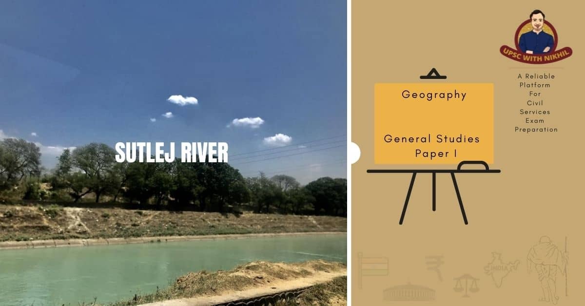
The Sutlej River is one of the five rivers that give Punjab its name, and it is an ancient river. It is one of the tributaries of the Indus River. Satluj enters India near Shipki La Pass and passes through numerous Himalayan valleys before merging with the Beas River in Punjab. The Beas River then merges with the Chenab in Pakistan before landing in the Indus. In the Vedic era, Sutudri was the name given to the Sutlej.
MORE ABOUT SUTLEJ RIVER
The Sutlej River rises in China's Western Tibet, near the source of the Indus, Ganges, and Brahmaputra rivers, in the Kailas mountain range. It has a length of 1,536 kilometres and a catchment area of 75369 square kilometres (of which 70 per cent is in India). Near Ferozepur, it enters Pakistan (Punjab) and eventually joins the Chenab River near the Punjnad barrage. There are eight major tributaries to the Sutlej River (all except Rohi Nullah join the Sutlej river in India). The Beas River, which is 464 kilometres long and has a catchment area of 9920 kilometers2, is the largest tributary.

From Mansarovar, the Sutlej River enters India and flows northwestward. It passes through massive Himalayan ranges on its way from the Shipki pass. It flows up to the Gobind Sagar Lake, where the Bhakra Dam is built. Nangal headworks are located 14 kilometres downstream of the Bhakra dam. The river continues to flow in a southerly direction from here. It enters the plains near Ropar after flowing for another 50 kilometres. Finally, it reaches Harike, where it meets the Beas River. During the monsoon season, floods can occur on both sides of the river.
In Pakistan, the river flows north of the Vindhya Mountain Range, south of the Hindu Kush division of the Himalayan Mountain Ranges, and east of the Central Sulaiman Range. The Sutlej River stretches for 1,450 kilometres. Various hydroelectric power and irrigation projects, such as the Kol Dam, Bhakra Nangal Dam, Baspa Hydroelectric Power Project, and Nathpa Jhakri Project, are located along the river.
The Sutlej River is frequently referred to as the Red River. It is the easternmost tributary of the Indus River. The Sutlej River originates near Lake Rakhastal in Tibet, near the Kailash Mountain Range. The Sutlej River usually flows west to southwest, entering India through the Shipki La Pass in Himachal Pradesh.
The very old and famous Bahawalpur State is drained by the Sutlej River. Cholistan is the dry area to the south and east. The Bahawalpur Division includes Cholistan as part of it.
The Sutlej River joins the Beas River in Hari-Ke-Patan in Amritsar, Punjab, India, and flows southwest through Pakistan, joining the Chenab River near Bahawalpur to form the Panjnad River (Five Rivers of Punjab). Mithankot is where the Punjab's Five Rivers meet the Indus River. The Indus River then flows through a canyon near Sukkur, through Sindh's fertile terrain, and finally into the Arabian Sea near Karachi, Pakistan.
The Indus Waters Treaty between Pakistan and India distributes the Satluj River's waters to India, which are primarily shifted to irrigation channels in India. The Karcham-Wangtoo Hydroelectric Dam, with a capacity of 1000 MW, the Bhakra Dam, with a capacity of 1000 MW, and the Nathpa Jhakri Hydroelectric Dam, with a capacity of 1650 MW, are among the hydropower projects built on the Sutlej River.

SUTLEJ YAMUNA LINK
A proposal has been made to connect the Sutlej and Yamuna rivers with a 214-kilometer-long heavy freight and irrigation canal known as the Sutlej-Yamuna Link (SYL). The project aims to link the Ganges River, which flows along the east coast of India, with points west via Pakistan.
When completed, the SYL will allow inland shipping from India's east coast to its west coast (on the Arabian Sea) without having to travel by sea around the country's southern tip. This will greatly reduce shipping distances, relieve pressure on seaports, avoid sea hazards, create business opportunities along the route, increase real estate values, increase tax revenue, and establish important commercial relationships.
The proposal, however, has run into roadblocks and has been referred to India's Supreme Court. Waters from Tso Moriri Lake/Lingdi Nadi (a tributary of Tso Moriri Lake) can be diverted to the Sutlej basin by digging a 10-kilometre-long gravity canal to connect to the Ungti Chu River to supplement nearly 100 tmcft water availability for the needs of this link canal.
THINGS TO SEE NEAR THE SUTLEJ
KALPA
Kalpa is located at an elevation of 2,960 metres in Himachal Pradesh's Kinnaur district. It's a lovely spot on the banks of the Sutlej River. Overlooking the Sutlej River, the Kinner Kailash massif offers breathtaking views. The beauty of Kalpa drew Lord Dalhousie, the former Governor General of India, to pay a visit. Dalhousie was so taken aback by the beauty of Kalpa that he built a charming summer cottage there. It's assumed that he communicated with the King of England from Kalpa, suggesting that England could be ruled from Kalpa during the summer. The attractive features of Kalpa, without a doubt, do that to all visitors. Kalpa is known for its high-quality chilgozas and apples, in addition to the breathtaking views.
SARAHAN (FAMOUS FOR THE BHIMAKALI TEMPLE)
Sarahan is yet another lovely town along the Sutlej River's route. The renowned Bhimakali Temple, the controlling goddess of the monarchs of the previous Bushahr State of Rampur, is located there. The Bhimakali Temple, which is an exotic combination of architectural patterns followed by both Hindu and Buddhist places of worship, is the town's main tourist attraction. The temple was carved out of rocks and wood. Three other temples in the Bhimakali Temple compound are dedicated to Lord Narsinghji, Raghunathji, and Patal Bhairva Ji.
TATTAPANI (FAMOUS FOR THE HOT SPRINGS)
Tattapani, also known as Taptapani, is situated at a height of 661 metres. It is a peaceful small village with many tourist attractions for those seeking relaxation, refreshment, and soft adventure.
Several small hot sulphur springs can be found along the right riverbanks of the Sutlej, which covers an area of more than one square kilometre. Because of the importance of these hot sulphur springs to the village, it was given the name "Tattapani." Tattapani is a Sanskrit word that means "hot water."
A bath here is extremely beneficial for those suffering from arthritic pains, any type of skin infection, or exhaustion.
Tattapani is more than just a destination for adventurers and nature lovers. For devotees, the location is also a well-known pilgrimage site. Thousands of Hindus flock to the site throughout the year. They believe that the month of Magha (between January and February) is the best time to take a bath. It is assumed that by taking a bath, you will be able to wash away all of your wrongdoings. Baisakhi (April 13) is also considered a good time to take a bath this spring. Thousands of religious devotees congregate here on the occasions of Lohri, which falls on January 26 each year, and Tara Ratri.
BHAKRA NANGAL DAM
The
Bhakra Nangal Dam was dubbed the "New Temple of Resurgent India" by Pandit Jawahar Lal Nehru, India's first prime minister. On the Sutlej River, the Bhakra Nangal Dam is located. The barrage is located in the Himachal Pradesh town of Bilaspur. The dam is one of India's largest structures. It is also the world's highest gravity dam. The dam, which is located on the border of Punjab and Himachal Pradesh and is surrounded by lush green forests, provides a spectacular view of the area and attracts visitors from all over India.
The dam has a height of 226 metres and a length of 518 metres at its pinnacle. At its base, the dam is 99 metres long and 402 metres wide. The Bhakra Nangal Project takes its name from two villages near the base of the lower Himalayan ranges: Bhakhra and Nangal.
Because it is India's largest dam, it attracts a large number of tourists throughout the year. The Himachal Pradesh Travel and Tourism Department has established guest houses near the Bhakra Nangal Dam to support tourism in this area of Himachal Pradesh. A natural fall, in addition to the man-made dam, is a source of hydroelectric power produced by the Ganguwal and Kotla Power Houses. Picnic spots abound along the dam's perimeter.